aREAL® – Software for urban development and land management
What is aREAL®?
aREAL® is a modern software application to support municipalities in the registration, digitalisation, administration and activation of inner-local potential areas and sustainable area management.
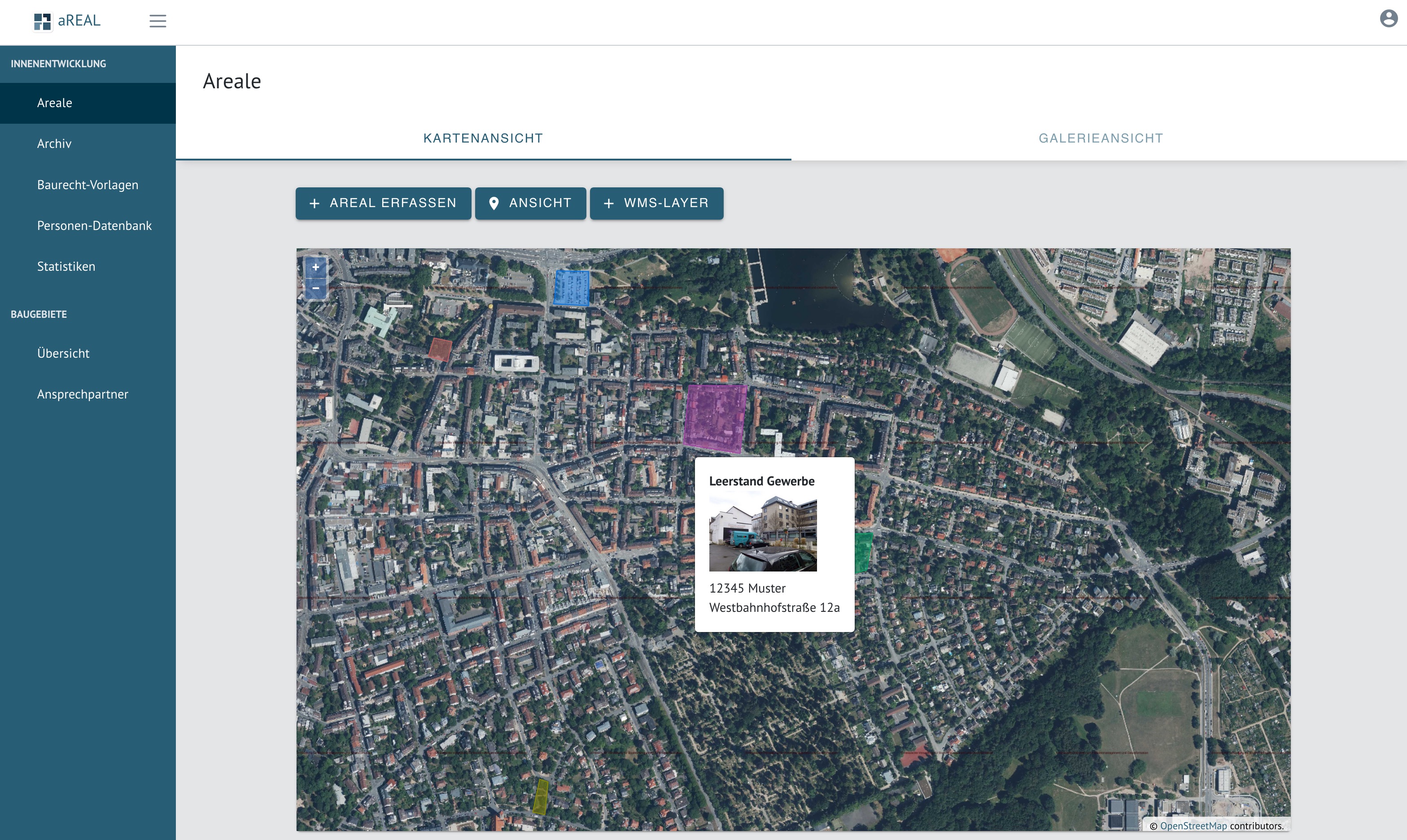
With the help of a real estate database, all necessary data is recorded. The web interface of the software enables a map-based representation of the areas maintained. It also includes entry and administration masks, for example for entering restrictions or possible use.
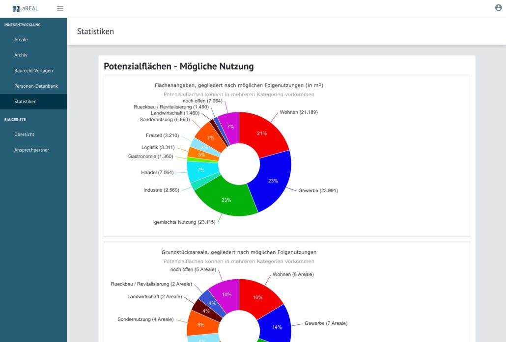
The map display can include your own geodata using WebMapServices. After successfully addressing the owner, the potential areas can be presented in a separate register card in the KIP with a high range. At the same time, statistical evaluations of the inner-local potential areas can be created, which is particularly required in the course of the designation of new building sites on the basis of BauGB § 1a, Paragraph 2 as a consideration fact in urban land-use planning.
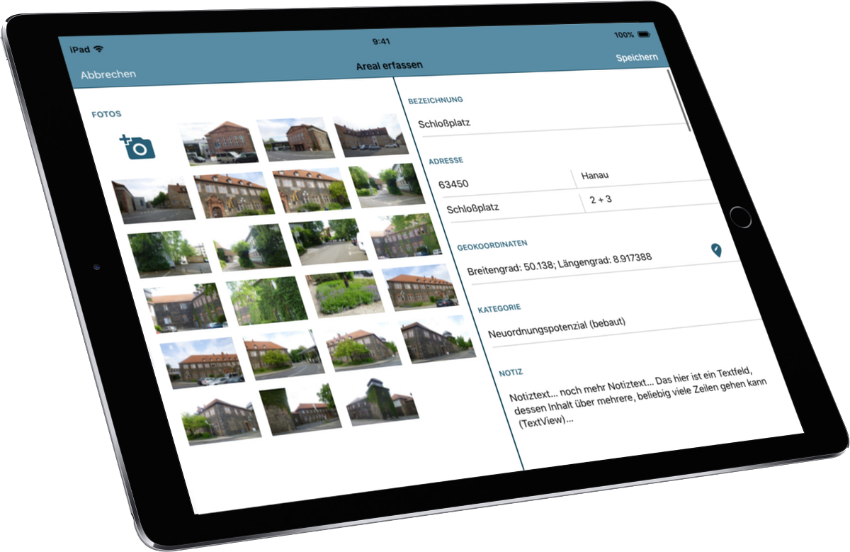
On request, an iPad app can also be used for on-site recording of potential areas. The recorded areas can be synchronized bidirectionally. The integration of a vacancy detector is also possible, via which citizens can be actively involved in the identification process.
aREAL® at a glance
- inner development potentials
- building site cadastre
- vacancy management
- brownfield site management
- Digital Instrument
- on-site acquisition
- space management
- owner dialogue
- Statistical evaluations
- Reduction of land consumption
- sustainability
Mobile recording
Internal development potentials can be determined both by automated procedures – for example by blending cadastral data with registration data and consumption data – and by knowledge workshops – but for a qualification of the data and an exact assessment on-site appointments are usually necessary. Here it offers itself to raise directly also appropriate data, like for instance pictures. For this reason, we have developed an internal development app that works seamlessly with the potential area database of aREAL®:
Digital Management
The clear online administration area of aREAL® offers a comfortable administration interface. There you can:
- Record areas in detail
- Edit the areas entered and maintain the data
- Create map views
- Store images and documents
- Calling Exposé Views
- Create PDFs of the exposés
- Start owner dialogs
- Archiving Areas
- View statistical evaluations
Publication
With the consent of the owner of a potential site, it can be published on KIP | The municipal real estate portal in the company’s own real estate exchange. All you have to do is start online marketing of the site. Potential investors and buyers thus have access to all relevant data and can contact the local government or the owner directly.
The publication does not take place thereby as classical purchase or renting offer, but in its own tab in the real estate portal, on which the later use does not have to be fixed at all in the detail yet. For example, the allocation of concepts can be controlled or the special “talents” of the space can be highlighted. It is important to note that the local authorities define the rough development they would like to see for the site as soon as it is published.


